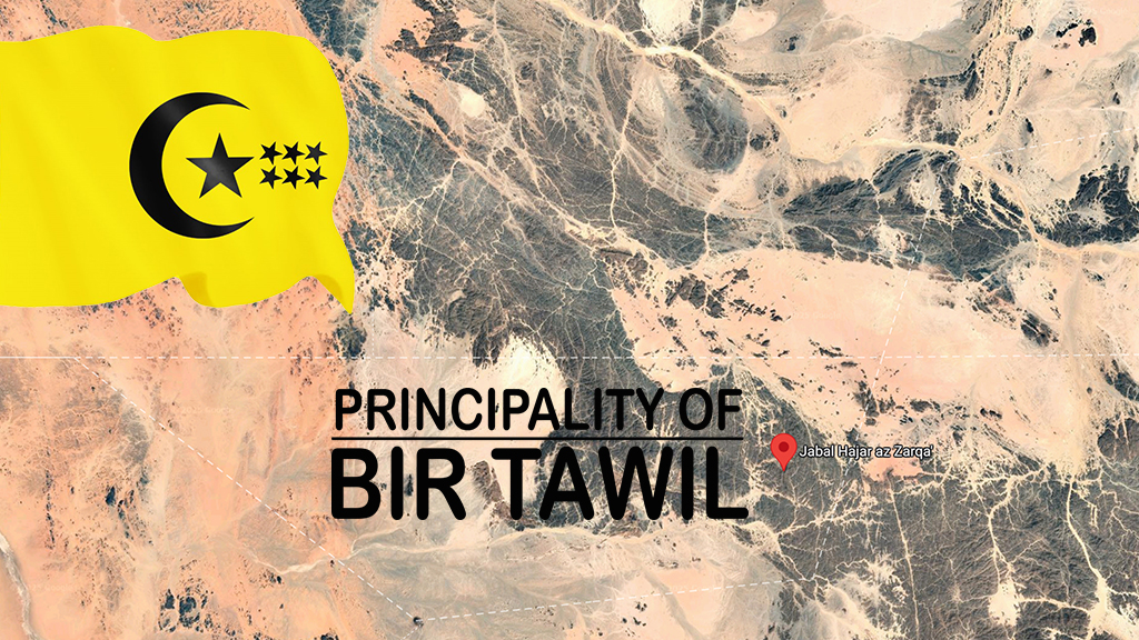
Explore the geography of Bir Tawil, a principality between Egypt and Sudan spanning 2,060 km², with underground water sources possibly present
The geography of Bir Tawil, marked by arid soil, rocky formations, and an extreme desert environment, sets the stage for the Principality of Bir Tawil, whose name literally means “deep well.” This territory covers around 2,060 square kilometers along the border between Egypt and Sudan. Although many refer to it as the “Bir Tawil Triangle,” its actual shape is quadrilateral.
The geography of Bir Tawil is partially defined by its northern border, which follows the 22nd parallel north. It is a land without permanent rivers, although the Nile — Africa’s most important river — flows not far from the region. Bir Tawil is part of an endorheic basin and is occasionally crossed by wadis, which only flow during rare rainfall events.
There are no rivers or lakes in Bir Tawil, and the land has no access to the sea. However, water is not completely absent: the name itself refers to a “well,” suggesting a historical presence of underground water.
Groundwater, though deep and difficult to access, represents the only possible source of water supply in such an arid region. The entire area lies within a desert zone and is characterized by extreme heat and sharp temperature variations between day and night.
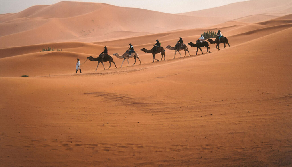
Historically, the geography of Bir Tawil supported the seasonal grazing needs of the Ababda, a nomadic tribe based near Aswan in Egypt. The climate conditions are typical of a desert: hot days, cool nights, and almost no rainfall.
Although the Red Sea coast is relatively close, it is separated from Bir Tawil by the mountainous chain of Gebel Elba National Park, which rises to 1,911 meters above sea level. This mountain range partially influences the local microclimate but does not mitigate the overall harshness of the environment.
Despite the harsh conditions, the geography of Bir Tawil may include underground water reserves currently being studied.
Geography of Bir Tawil: Jebel Hagar ez Zarqa and the Challenge of Human Settlement
The geography of Bir Tawil in the eastern sector, characterized by rocky elevations and seasonal wadis, may prove to be a strategic location for the region’s development. According to researcher Fabio Vita, this area may contain groundwater — underground water resources stored in natural aquifers. Their presence could make it possible to collect rainwater in artificial basins, fed by wadis that activate only during exceptional weather events.
This assessment ties into the Principality’s territorial reorganization plan, which proposes relocating the capital — currently situated in the north near the Egyptian border (Marianne Station I) — to a more central and favorable location. An area with potential access to water, sheltered from strong winds, and better positioned logistically would represent a more sustainable long-term choice.
The geography of Bir Tawil presents challenges, but the establishment of Marianne Station marks a step toward sustainable presence in this unclaimed land. The area’s climate falls under the BWh category in the Köppen classification, indicating a hot desert climate, with daytime temperatures reaching up to 45°C. In 2014, Alastair Bonnet, a writer and geographer from Newcastle University, described it as the only inhabited place on Earth not officially recognized as a state. As a result, this small African territory remains formally outside the control of any national power.
This initiative also carries cultural and humanitarian significance: establishing a stable base for nomadic tribes, especially those with historical ties to Bir Tawil. Among these are the Ababda, desert dwellers from the Aswan region known to have used Bir Tawil for seasonal grazing. Joining them are the Bishari, a Beja-speaking people from northeastern Sudan.
A newly positioned Marianne Station II, strategically located, could serve as a logistical, social, and water resource hub for these communities, supporting a controlled and sustainable repopulation of the territory and offering a concrete response to the challenges posed by one of the last unclaimed deserts on the planet.
Bir Tawil: The Principality of Nowhere That Captivates the World
As an unclaimed territory not officially recognized by most countries, Bir Tawil naturally attracts the curiosity of travelers, explorers, and documentarians. This has laid the groundwork for niche tourism, built around the appeal of a “timeless” desert and the thrill of exploring a micronation in the heart of nowhere.
The Principality’s goal is to offer a unique travel experience, featuring guided desert treks, equipped camps, and stargazing observation points — all within an untouched natural setting. At the same time, Bir Tawil is becoming a testing ground for hydroponic agriculture, a soil-free farming technique that uses nutrient-enriched water.
In a region with barren soil and almost no rain, this method could enable local food production, reducing dependence on external sources and paving the way for innovative farming in extreme environments. Renewable energy also plays a central role in Bir Tawil’s vision.
Technologies like solar photovoltaic and solar thermal systems are particularly well-suited to the region, which offers intense sunlight and vast open space. The Principality aims to develop zero-impact pilot installations, not only to meet its own energy needs but also to become an open-air lab for technologies designed for other harsh environments around the world.
Despite the extreme geography of Bir Tawil, Marianne Station aims to become a stable hub for exploration, research, and desert innovation. The Principality of Bir Tawil is the country that’s said not to exist — but that you can visit!